 Monte Dourado, Pará
Monte Dourado, Pará
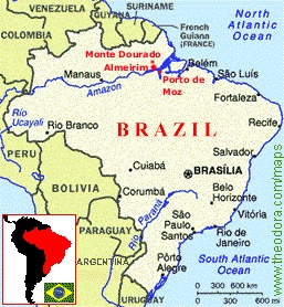
Monte Dourado, ParáThe map shows our approximate location in northern Brazil.
Monte Dourado is in the municipality of Almeirim, one of the largest extensions of land in the Brazilian state of Pará. Almeirim City lies on the north bank of the Amazon River near the outlet of the Xingu River , about 3 degrees south of the equator. Year-round, we experience 12-hour days and 12-hour nights and constant tropical heat. Our 'summer' runs from June to November and our rainier 'winter' runs from December to May, but one can count on both seasons being hot and humid. There is a large indigenous area with restricted access in the north near the source of the Parú river.
The population of Almeirim is about 30,000, and is divided between city dwellers and those that live in the various villages of the interior. City dwellers generally live in either Almeirim City (on the bank of the Amazon) or Monte Dourado, an industrial pole 3 hours north of Almeirim City by vehicle over a treacherous dirt road. (It is also possible to travel by line boat to Monte Dourado from Almeirim City via the Jarí River, a trip which takes about 12 hours.) The Jarí River forms the divide between the states of Pará (ours) and Amapá.
See pictures around our region, and please visit our blog for more updated photos of our ministry and area!
![]()
![]()
Our local time:
![]()
![]()
![]()
![]()
Map courtesy of www.theodora.com/maps, used with permission.